Before There Was a County—or a Country: Garrett County’s Revolutionary War Roots
Long before Garrett County had a name, and even before the United States fully existed as a nation, the mountains of far‑western Maryland were a remote and largely unmapped frontier. In the 1700’s this high country lay beyond the settled world, a rugged landscape of dense forests, steep ridges, and narrow valleys known only to a handful of traders, surveyors, and Indigenous peoples who had moved through it for generations.
As the Revolutionary War drew to a close, Maryland faced the challenge of compensating the soldiers of the Maryland Line for their service. With little money but abundant western land, the state turned to its frontier.
In 1777 the Maryland General Assembly in Annapolis passed An act for recruiting the quota of troops of this state in the American army, and furnishing them with cloathing and other necessaries.
“Every effective recruit is to receive, besides the continental allowances, a bounty of forty dollars, a pair of shoes, a pair of stockings, and at the expiration of his term, provided he shall not desert from the army, 50 acres of land, to be procured and laid off as aforesaid, to him or his representative” (Laws of Maryland 1763-1784, page 182).
Officers were to receive four lots of 50 acres each. Land was also to be granted to those who recruited soldiers to fight in the Revolutionary War.
The Assembly agreed that “all the lands in Washington county, westward of Fort Cumberland, except as in the said act is excepted, were appropriated to discharge the engagement of lands heretofore made to the officers and soldiers of this state.” The land to be allotted was that “beginning at the mouth of Savage river, and running with the north branch of Patowmack river to the head thereof, then north with the present supposed boundary line of Maryland until the intersection of an east line to be drawn from the said boundary line, with a north course from the mouth of Savage river” (Laws of Maryland 1785-1791, page 350). This land is now in Allegany and Garrett counties.
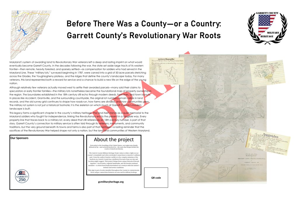
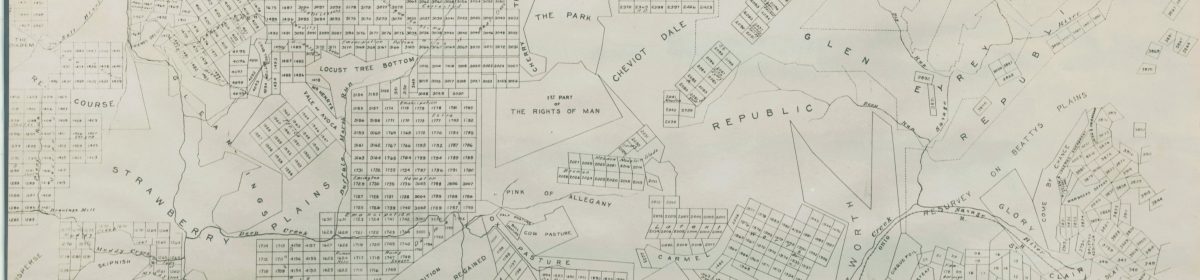
Colonel Francis Deakins was appointed to “lay out the manors, and such parts of the reserves and vacant lands belonging to this state, lying to the westward of Fort Cumberland, as he might think fit and capable of being settled and improved, in lots of fifty acres each” (Laws of Maryland 1785-1791, page 351). Starting in 1787 he, with the help of 10 surveyors, returned a general plot of the state of Maryland west of Fort Cumberland (now Cumberland in Allegany County), on which 4165 lots of fifty acres each are laid out. Deakins also found 323 families already living on 636 of these lots, and the Assembly agreed that settlers could purchase the land.
These lots were surveyed before the Constitution was ratified, before the borders of future towns were imagined, and decades before Garrett County itself was created in 1872. Yet the work done in that brief window after the Revolution left a permanent imprint. Although few veterans ever settled their claims, the lots they were granted became the building blocks of land ownership in the region. Early settlers purchased the parcels, farms grew from them, and later property divisions followed their lines.
Today, the geometry of those 1787 surveys still shapes the county. Modern deeds reference the same lot numbers. Property boundaries trace the same angles. Roads and communities often follow the edges of those original squares. The Revolutionary War may feel distant, but its legacy is literally inscribed on the land.
In Garrett County, the story of the nation’s founding is not only told in documents or monuments—it is written into the very map. The military lots stand as a quiet but enduring reminder that the county’s roots reach back to a time before the county existed, before the frontier was settled, and before the United States had fully taken shape.
For more information:
- Western Maryland Historical Library (WHILBR).
Military Lots Assigned to Soldiers, Garrett County, Maryland. 1787.
https://digital.whilbr.org/digital/collection/p16715coll66 - Maryland State Archives. Land Records: Overview of Maryland Land Grants, including Revolutionary War bounty lands west of Fort Cumberland. https://guide.msa.maryland.gov/pages/series.aspx?id=S451
- Mountain Discoveries. Military Lots Awarded For Revolutionary War Service. Written by Dan Whetzel. http://www.mountaindiscoveries.com/images/fw2014/12story.pdf