A Doomed Campaign Forges the Father of a Nation
The region that would later become Garrett County, Maryland lay along an important frontier corridor during the French and Indian War. Although the county itself was not formally created until 1872, the rugged Allegheny highlands that define the area formed a natural passage through the mountains linking the eastern colonies to the Ohio Valley. Native American trails and early colonial routes crossed this terrain, creating strategic pathways that both British and French forces recognized as vital for moving troops and supplies westward. These routes would later be formalized into what became the U.S. Route 40 corridor, which follows much of the historic line of travel through the mountains.
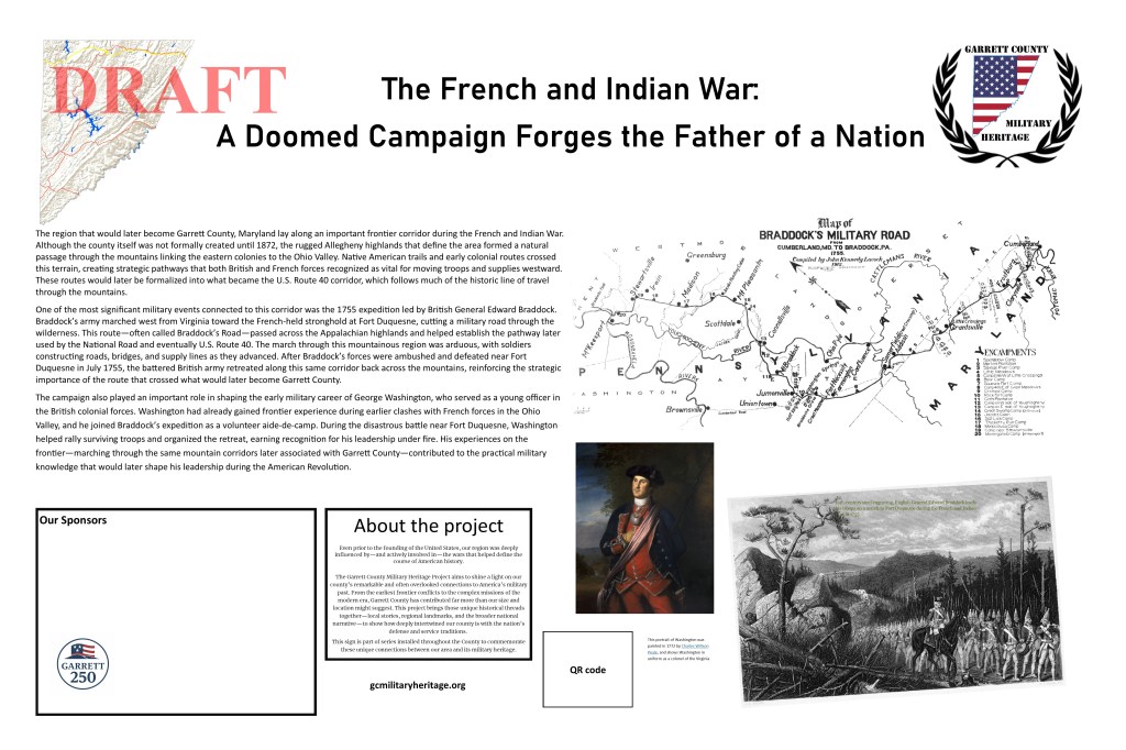
One of the most significant military events connected to this corridor was the 1755 expedition led by British General Edward Braddock. Braddock’s army marched west from Virginia toward the French-held stronghold at Fort Duquesne, cutting a military road through the wilderness. This route—often called Braddock’s Road—passed across the Appalachian highlands and helped establish the pathway later used by the National Road and eventually U.S. Route 40. The march through this mountainous region was arduous, with soldiers constructing roads, bridges, and supply lines as they advanced. After Braddock’s forces were ambushed and defeated near Fort Duquesne in July 1755, the battered British army retreated along this same corridor back across the mountains, reinforcing the strategic importance of the route that crossed what would later become Garrett County.
The campaign also played an important role in shaping the early military career of George Washington, who served as a young officer in the British colonial forces. Washington had already gained frontier experience during earlier clashes with French forces in the Ohio Valley, and he joined Braddock’s expedition as a volunteer aide-de-camp. During the disastrous battle near Fort Duquesne, Washington helped rally surviving troops and organized the retreat, earning recognition for his leadership under fire. His experiences on the frontier—marching through the same mountain corridors later associated with Garrett County—contributed to the practical military knowledge that would later shape his leadership during the American Revolution.
- ArcGIS StoryMaps.
“More Like a Leading Avenue” – Native American and Early Trail Networks in Western Maryland.
https://storymaps.arcgis.com/stories/1b8940c08d574e02a9033da0cd7741e9 - Western Maryland Regional Library (WHILBR).
Archeological Overview of Western Maryland (French and Indian War impacts).
https://www.whilbr.org/sites/default/files/2023-03/Archeological_Overview-part2.pdf - Garrett County Genealogy
Histories of Garrett County – French and Indian War Context.
https://genealogy.garrettcountyhistory.com/histories/